Future Climate Info products
Future Climate Info
Overview
A fresh approach to an age-old risk, the newest CON29M Official Coal Mining Search from the original experts, with unique inclusive AA- rated insurance protection.
The Official CON29M search which puts your client’s needs first. Providing peace of mind for conveyancers and solicitors with a combination of expert risk interpretation and unparalleled insurance protection for homebuyers, vendors and lenders as standard.
Includes:
- All 11 Official CON29M enquiries
- Mine Entry Interpretive Report*
- Development Considerations
- Coal Search Insurance
- Non-Coal Minerals Search Insurance
- Cheshire Brine Screen
- Cheshire Brine Insurance
Key features at a glance
- Official CON29M: Licensed by the Law Society to include all 11 Official CON29M Coal Search questions, presented with a clear front page summary for easy reference.
- Unique, Inclusive Triple-Tier Insurance Protection+, from Great Lakes SE:
- Market-leading Coal Search Insurance: All the protection you’d expect from £100k Coal Search Insurance, with the addition of unique features such as cover for loss-of-value caused by historic mining features which were not recorded in the Coal Authority data at the time of reporting but are later revealed in any subsequent CON29M search+.
- Non-Coal Minerals Search Insurance: The only Search to provide protection in relation to thousands of non-coal mining features recorded in the Coal Authority data which may not qualify for assistance under the Coal Mining Subsidence Act 1991, should they be the cause of subsidence damage to the property+.
- Cheshire Brine Screen, with Integrated Insurance: A screen in every report, with insurance included automatically for any property within the Cheshire Brine Compensation District, avoiding the need for costly additional searches+.
- Mine Entry Interpretive Report (MEIR)*: A comprehensive assessment included as standard, with no need for an additional search. We go beyond the minimum requirements of the Law Society guidance and consider all mine entries where the calculated zone of influence encroaches on the property boundary, not just those within a set 20m radius.
- Development Considerations: Identifies if the property is within a Development High Risk Area, where redevelopment ambitions may require specialist advice.
Official CON29M
Analyses the impacts from key risks listed by The Law Society including Past Underground Coal Mining, Present Underground Coal Mining, Future Underground Coal Mining, Mine Entries - Shafts & Adits, Coal Mining Geology, Past Opencast Coal Mining, Present Opencast Coal Mining, Future Opencast Coal Mining, Coal Mining Subsidence Claims, Mine Gas Emissions, Emergency surface hazard call out incidents, PLUS Development Risk Areas and Cheshire Brine Compensation District.
Please view our sample report and product card for more information.
(+) Insurance subject to specific Terms and Conditions. Great Lakes SE is a subsidiary of Munich RE.
(*) Mine Entry Interpretive Report provided where a mine entry is identified.
Please log in or register if you are interested in ordering this product.

Overview
Available for properties <15Ha, this product is aimed at other commercial and industrial units and contains the following four datasets:
- Environmental
- Flood
- Ground Stability
- Energy & Infrastructure
Includes FCI partner Earthsense’s unique national Air Quality dataset, MappAir, and features clear outcome graphics and enhanced mapping. FCI Commercial also comes with expert support from FCI’s Risk Team.
Professional Indemnity Cover
Supported by £10 million professional indemnity cover.
Please log in or register if you are interested in ordering this product.
Overview
Available for properties >15Ha - <50 Ha, this product is aimed at other commercial and industrial units and contains the following four datasets:
- Environmental
- Flood
- Ground Stability
- Energy & Infrastructure
Includes FCI partner Earthsense’s unique national Air Quality dataset, MappAir, and features clear outcome graphics and enhanced mapping. FCI Commercial also comes with expert support from FCI’s Risk Team.
Professional Indemnity Cover
Supported by £10 million professional indemnity cover.
Please log in or register if you are interested in ordering this product.
Overview
Available for properties >50Ha - <150 Ha¿¿¿¿, this product is aimed at other commercial and industrial units and contains the following four datasets:
- Environmental
- Flood
- Ground Stability
- Energy & Infrastructure
Includes FCI partner Earthsense’s unique national Air Quality dataset, MappAir, and features clear outcome graphics and enhanced mapping. FCI Commercial also comes with expert support from FCI’s Risk Team.
Professional Indemnity Cover
Supported by £10 million professional indemnity cover.
Please log in or register if you are interested in ordering this product.

Overview
The FCI Flood Appraisal is a property specific, fully manually assessed report, delivering a detailed analysis of the flood risk. It has been designed specifically to provide additional insight following a ‘Further Action’ flood risk result on an initial environmental search report, and to satisfy the requirements of the Law Society Flood Practice Note in obtaining suitable further information.
Derived from complementary data sources and flood mapping, coupled with expert independent insight from Ashfield Solutions Group’s experienced team, the report provides clarity, and ultimately makes those all-important property acquisition or investment decisions that much easier.
- Manual Assessment: by a qualified Flood Consultant.
- Professional Opinion: with clear Outcomes and details of Revised Flood Risk.
- Property-Specific: considers additional factors (e.g. Ground Levels, Property Thresholds or the presence of Basements) as part of the assessment.
- Location Context: review of Property Photography (where available or provided).
- Key Research: review of Local Authority Records and Planning Applications.
- Local Attributes: details of Flood Defences and Flood Warning / Alert History.
- Forward Planning: advice on potential Redevelopment Constraints & Occupation / Operational Risks.
- Robust Due Diligence: complies with the Law Society’s Flood Risk Practice Note.
- Clear Recommendations: given where required for appropriate Resilience or Resistance measures.
- Outcomes: summary of potential Impacts, and a clear Insurability Statement.
Please view product card and sample report for full details.
Please log in or register if you are interested in ordering this product.
Please log in or register if you are interested in ordering this product.
Please log in or register if you are interested in ordering this product.
Please log in or register if you are interested in ordering this product.

Overview
FCI Planning highlights possible planning and development constraints and major developments which may have an impact on the homebuyer’s enjoyment, plans and the potential future value of their property.
The report includes Local Authority planning and development data from LandInsight, providing information on the types of developments which have taken place in the local area surrounding the property for the preceding 10 years.
The FCI Planning report features;
- Intuitive categorisation of the data Clear planning map
- Dynamic buffers to capture larger developments
- Data pulled live for each report
- Clear and concise results. Not overly wordy
- Current and Historical records
- Lawful Planning Certificates (shown where available)
Planning records include;
- Extensions and Small New Builds
- Developments
- Change of Use
- Lawful Development Certificate Applications
- Telecoms
- Planning Restrictions
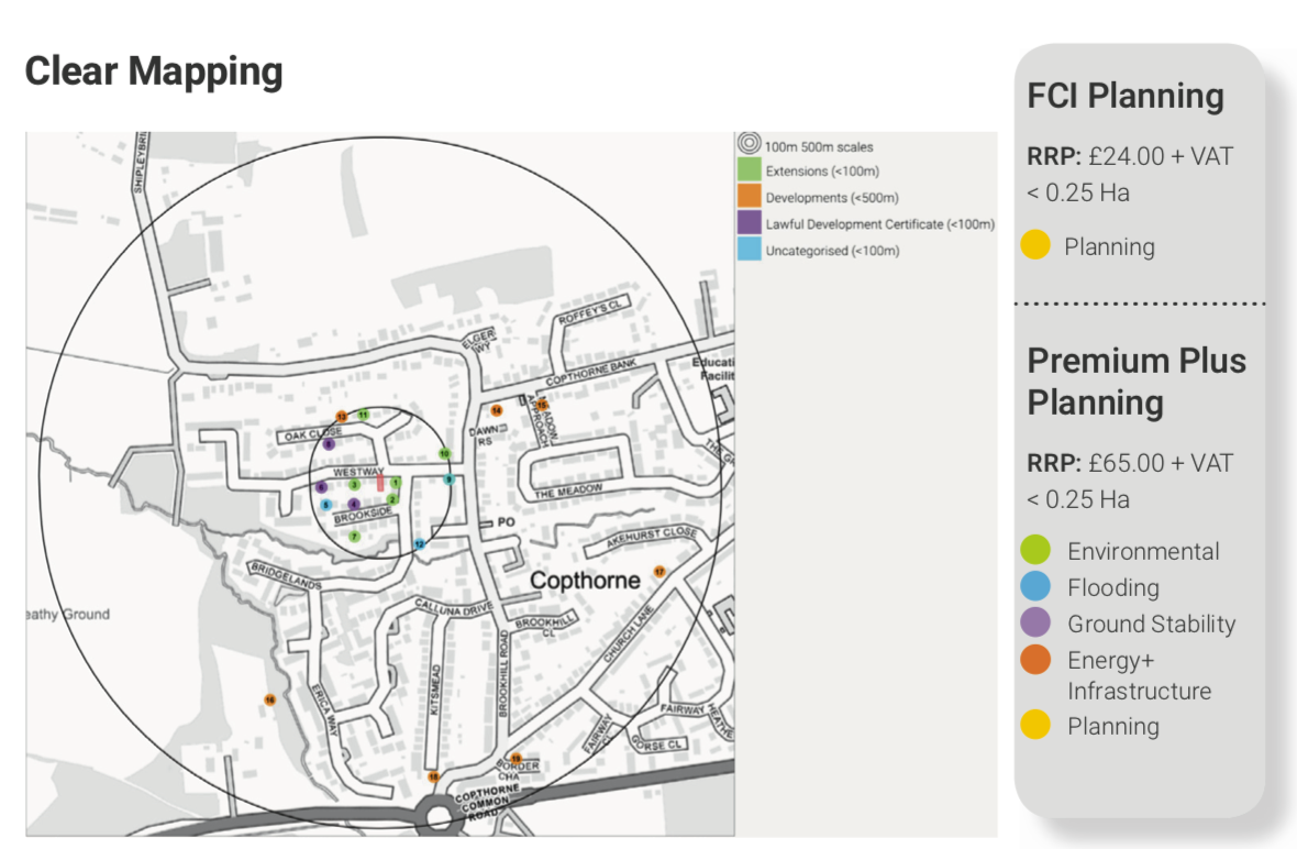 For relevance and improved usability, the search radius is flexible dependent on the location of the property, whether it be in an urban, rural or densely populated urban area, ensuring a manageable representation of planning applications and developments, displayed clearly by type for ease of review in order of proximity from the property.
Please view product card and sample report for more details.
Please log in or register if you are interested in ordering this product.

Overview
Premium Plus Planning Report has all the benefits of the best-selling FCI Premium, with the addition of Planning, providing the information needed to make informed purchase decisions.
Features include:
- Planning: Planning and development activity in the local area surrounding the property for the preceding 10 years, including planning restrictions and major developments which may have an impact on the homebuyer’s enjoyment, plans and the potential future value of their property.
- Environmental: Past and current potentially contaminative land uses, radon gas, permits, incidents & notices; Unique Air quality data from EarthSense.
- Flood: Flooding from Rivers, Sea and Surface Water; Groundwater Susceptibility; Historic Flooding; JBA Floodability data.
- Ground Stability: Natural geo-hazards including natural cavities, clay shrinkage, landslips and sink holes; past and current non-coal mining risks including Brine, Limestone, Tin, China Clay and Ball Clay.
- Energy & Infrastructure: Potential impacts from Shale, gas and other mineral extraction; power utilities; major transport projects like HS2 and Crossrail; solar and wind farms
- Air Quality: EarthSense’s MappAir® data is the first ever high resolution nationwide map of air pollution, providing an Air Quality Rating from the UK’s leading air quality experts.
Market leading support for clients
- Professional opinion: with clear report outcomes.
- Free remediation warranty: passed residential environmental reports come with protection for 6 years, up to £100,000.
- Planning: Local Authority planning data from LandInsight, providing information on the types of development which have taken place in the surrounding area, and highlighting possible development constraints which may be of relevance to home buyers.
- Free Further Action Review: upon evidence of remediation, within 24 working hours.
- Subsidence risk rating: accurate to the individual postcode, the Subsidence Risk Rating from Property Assure provides an instant rating and a clear summary of the risk, based on actual insurance claims data.
- Detailed flood reporting: our individual flood thumbnails provide a detailed map illustrating the extent of each type of flood risk and JBA’s Floodability rating helps to provide an overall flood risk rating for the property.
- Affordable next step solutions: to keep the transaction moving forward.
Please view product card and sample report for more details.
Please log in or register if you are interested in ordering this product.

Overview
A complete Environmental and CON29M due diligence report for conveyancers, with unique inclusive AA- rated insurance protection for ultimate peace of mind
Premium Plus CON29M combines assessment of the core Environmental risks with an Official CON29M Coal Mining report and Triple-Tier Insurance Protection. Providing peace of mind for conveyancers with a combination of expert risk interpretation and protection for homebuyers, vendors and lenders, as standard.
Key features at a glance
- Official CON29M: Licensed by the Law Society to include all 11 Official CON29M Coal Search questions, presented with a clear front page summary for easy reference.
- Unique, Inclusive Triple-Tier Insurance Protection+, from Great Lakes SE:
- Market-leading Coal Search Insurance: All the protection you’d expect from £100k Coal Search Insurance, with the addition of unique features such as cover for loss-of-value caused by historic mining features which were not recorded in the Coal Authority data at the time of reporting but are later revealed in any subsequent CON29M search+.
- Non-Coal Minerals Search Insurance: The only Search to provide protection in relation to thousands of non-coal mining features recorded in the Coal Authority data which may not qualify for assistance under the Coal Mining Subsidence Act 1991, should they be the cause of subsidence damage to the property+.
- Cheshire Brine Screen, with Integrated Insurance: A screen in every report, with insurance included automatically for any property within the Cheshire Brine Compensation District, avoiding the need for costly additional searches+.
- Mine Entry Interpretive Report (MEIR)*: A comprehensive assessment included as standard, with no need for an additional search. We go beyond the minimum requirements of the Law Society guidance and consider all mine entries where the calculated zone of influence encroaches on the property boundary, not just those within a set 20m radius.
- Development Considerations: Identifies if the property is within a Development High Risk Area, where redevelopment ambitions may require specialist advice.
- Full Flood reporting: Flood thumbnails detail each type of flood risk and JBA’s Floodability score provides an overall rating for the property and its insurability.
- Air Quality rating: From EarthSense, the UK’s leading air quality experts.
- Free Remediation Warranty: Providing protection for 6 years, up to £100,000 on passed residential environmental reports.
Please view sample report and product card for more details.
(+) Insurance subject to specific Terms and Conditions. Great Lakes SE is a subsidiary of Munich RE.
(*) A Mine Entry Interpretive Report is provided where a mine entry is identified.
Please log in or register if you are interested in ordering this product.
Overview
This product is aimed at small retail premises (Use Classes: A1 – A5, C4) and comprises the following three datasets:
- Environmental
- Flood
- Ground Stability
Dedicated to the specific needs of retailers and small businesses, and for smaller commercial property transactions with continued existing use (not redevelopment), FCI Retail includes FCI partner Earthsense’s unique national Air Quality dataset, MappAir.
Available for properties up to 0.25 hectares, it is the best value report for small commercial properties.
Professional Indemnity Cover
It is the only commercial report to include a £100,000 6-year remediation warranty and is also supported by £5 million professional indemnity cover, making it a great value report for small commercial properties.
Please log in or register if you are interested in ordering this product.
Please log in or register if you are interested in ordering this product.
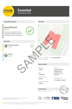
Overview
The FCI Essential report will identify environmental and flood risks (with a Professional Opinion provided on all data), meeting the requirements of the Law Society’s guidance on flooding and contaminated land.
The report now includes JBA 5 metre groundwater data, which indicates the risk of flooding in every 5 metre square across the country, providing a greater level of detail and allowing for more specific reporting using a simple ‘traffic light’ system.
Professional Indemnity Cover
For peace of mind, FCI Reports are backed by £10 million Professional Indemnity Insurance.
Free Further Action Review
It may be possible to revise a Further Action result free of charge if you are able to provide further information highlighting the remediation of a site. The FCI team will review and respond normally within 24 working hours at no extra cost. Simply email info@futureclimateinfo.com for more information.
Please log in or register if you are interested in ordering this product.
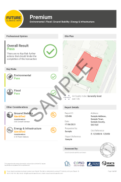
Overview
The FCI Premium report will identify environmental, flood, ground stability and Energy & Infrastructure risks (with a Professional Opinion provided on all data). Contains all of the information from the Standard report and includes data on Energy & Infrastructure such as wind farms, shale gas exploration, and HS2.
The report now includes JBA 5 metre groundwater data, which indicates the risk of flooding in every 5 metre square across the country, providing a greater level of detail and allowing for more specific reporting using a simple ‘traffic light’ system.
Professional Indemnity Cover
For peace of mind, FCI Reports are backed by £10 million Professional Indemnity Insurance.
Free Further Action Review
It may be possible to revise a Further Action result free of charge if you are able to provide further information highlighting the remediation of a site. The FCI team will review and respond normally within 24 working hours at no extra cost. Simply email info@futureclimateinfo.com for more information.
Please log in or register if you are interested in ordering this product.

Overview
The FCI Standard Premium report will identify environmental, flood, ground stability and Energy & Infrastructure risks (with a Professional Opinion provided on all data). Contains all of the information from the Standard report and includes data on Energy & Infrastructure such as wind farms, shale gas exploration, and HS2.
The report now includes JBA 5 metre groundwater data, which indicates the risk of flooding in every 5 metre square across the country, providing a greater level of detail and allowing for more specific reporting using a simple ‘traffic light’ system.
Professional Indemnity Cover
For peace of mind, FCI Reports are backed by £10 million Professional Indemnity Insurance.
Free Further Action Review
It may be possible to revise a Further Action result free of charge if you are able to provide further information highlighting the remediation of a site. The FCI team will review and respond normally within 24 working hours at no extra cost. Simply email info@futureclimateinfo.com for more information.
Please log in or register if you are interested in ordering this product.

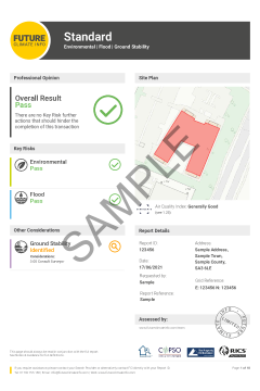
Overview
The FCI Standard Residential report will identify environmental, flood, and ground stability risks (with a Professional Opinion provided on all data). Now includes JBA 5 metre groundwater data, which indicates the risk of flooding in every 5 metre square across the country, providing a greater level of detail and allowing for more specific reporting using a simple ‘traffic light’ system.
Professional Indemnity Cover
For peace of mind, FCI Reports are backed by £10 million Professional Indemnity Insurance.
Free Further Action Review
It may be possible to revise a Further Action result free of charge if you are able to provide further information highlighting the remediation of a site. The FCI team will review and respond normally within 24 working hours at no extra cost. Simply email info@futureclimateinfo.com for more information.
Please log in or register if you are interested in ordering this product.