
Landmark Planning and DevAssess
Supplied by: Landmark
Overview
This combined product incorporates Landmark's Planning with the DevAssess Report by DevAssist.
1. Landmark Planning
The Landmark Planning report will give your clients details on whether there are nearby planning applications that may impact the property as well as any types of development that are currently being carried out in the area.
What’s Included:
- Planning applications
- Land use designations
- Housing and neighbourhood demographics
- Amenities and education
- Rights of way
The Landmark Planning report includes the addition of useful ‘neighbourhood’ information; such as the location of telecoms masts, local footpaths, nearby schools and their performance, housing types and average prices, population demographics and local amenities. This will better inform your client, ensuring they are aware of planning decisions and socio-demographic knowledge within the surrounding area of their potential property.
2. DevAssess
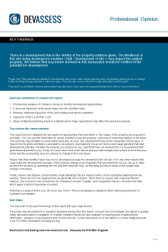
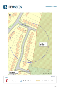
DevAssess establishes the development risk within a 75m radius from the centre of the property and identifies the new build development potential of the property. Combining existing planning information with a comprehensive investigation that exposes unexploited development sites, DevAssess reveals relevant potential development activity to homebuyers and nuisance planning applications that could affect the homebuyers enjoyment of the property. Altered views and loss of privacy can significantly reduce the value of some properties.
The report also identifies the new build development potential of the property. By exposing the hidden value, buyers could make a home an even better investment.
The report includes:
- Planning data included at no extra cost
- Identification of relevant historic planning applications within the search radius
- Explanation of Local Plan Policy
- Identification of potential future development sites where no relevant planning history exists
- Identification of land allocated for development where no relevant planning history exists
- Identification of development potential of the property
- OS Mapping identifying potential development sites
View product card and sample report for full details.
Please log in or register if you are interested in ordering this product.
Popular Products
Electricity Company Map Search
This search will obtain a plan provided from the relevant electricity company showing the location of their assets.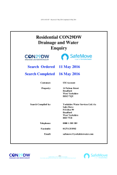
CON29DW Safemove (Yorkshire Water)
This official CON29DW, available from OneSearch Direct, provides comprehensive data on water supply, sewer connection status and charging arrangements.