GeoRisk Plus Commercial
Supplied by: Groundsure
Overview
Historic mining and ground stability affects properties across the country - your clients’ transactions need protecting.
A full mining solution for the conveyancing process - the only desktop mining report you will ever need. Groundsure GeoRisk is not just data – the report’s value rests on advanced data analysis delivering expert insight, interpretation and an extensive understanding of natural and man-made ground risks to property.
- GeoRisk provides a detailed assessment of mining and ground risk backed up by in depth and vast datasets covering five key areas: Non-coal mining (with opinion provided by an in-house mining expert)
- Ground stability (non-mining, both natural and non-natural)
- Satellite monitoring (recorded ‘real-world’ ground movement brought to you by SatSense)
- Coal mining (GeoRisk +)*
- Brine* (GeoRisk +)* *GeoRisk + includes everything in the GeoRisk report plus a fully comprehensive Groundsure CON29M Official Coal Mining Search Report (including a mine entry interpretive assessment) and a Cheshire Salt Search where required.
What is in GeoRisk
MSUK Mining Features: Unique and authoritative data on past mining features and associated infrastructure derived from mine plans and other sources, collated and curated by MSUK across 40 years of consulting.
Mining Records: Rich data indicating the presence or likelihood of past mining activity from a variety of authoritative sources.
Historical features: Past mining activity as depicted on historical maps. Mining features from Groundsure’s unique and comprehensive Historical Land Use Database derived from analysis of 1.5 million high resolution scans of historical OS maps.
Geological features: Geological data from the British Geological Survey (BGS) that could indicate the presence of past mining activity. This data is provided at the highest resolution available (1:10,000 scale).
Oil and gas extraction: Data on the presence or potential presence of oil and gas extraction. Information on exploration areas (‘licensed’ and ‘offered’), alongside existing wells and, unique to Groundsure, potential wells identified in the planning system - giving advanced warning of future development.
Satellite monitoring: Satellite radar data analysed to measure real-world ground movement, accurate to the millimetre. Produced by ground movement experts SatSense and updated every six days on a continuous cycle. Risk to property is summarised into a simple traffic light system across six risk indices, relating to different spatial scales and types of movement.
Natural instability: Comprehensive natural instability data including brand new BGS data on the risk from shrink-swell subsidence. It looks at geology, the presence of trees (Bluesky’s National Tree Map), and local building attributes to deliver a clear hazard score. Full GeoSure data is also included, natural cavities data and the BGS National Landslides Index.
Infilled land: Areas of infilled land can often indicate ground instability. Data is provided on current and historical landfills, along with unique and proprietary data derived from historical mapping and local authority records.
Sinkholes: A comprehensive alert to the likely presence of sinkholes. Includes recent sinkhole incidents in media reports, incidents recorded by the BGS and PBA, and past incidents from Groundsure’s Historical Land Use Database.
Coastal erosion: Understand risks to property from loss of land to the sea. Projections on imminent risk are provided alongside potential risk to your clients’ long term property investment
Coal mining alert: Alerts to a need for a full coal mining risk assessment if the property is within the Coal Mining Reporting Area.
Cheshire brine alert: Alerts to a need for a full brine risk assessment if the property is within the Cheshire Brine Compensation District.
What is in GeoRisk +
GeoRisk + includes everything in the GeoRisk report plus a fully comprehensive Groundsure CON29M Official Coal Mining Search Report (including a mine entry interpretive assessment) and a Cheshire Salt Search where required.
Coal mining (CON29M): A full assessment of the potential risk from coal mining with a CON29M Official Coal Mining Search integrated into the report and risk assessment. Also includes a mine entry interpretive assessment as standard. Residential and commercial versions available where applicable.
Cheshire brine: A full Cheshire Salt Search is included with the report when the property is within the Cheshire Brine Compensation District and includes further information on records held by the Cheshire Brine Subsidence Compensation Board.
GeoRisk gives the expert, bespoke view needed for property and land transactions, with a clean design and user friendly easy to navigate layout. GeoRisk has been designed and enhanced with comprehensive data features, clean and easy to read layout and design for clearer navigation - streamlining workflow. Where the comprehensive GeoRisk Alerts give the all-clear for specific or combinations of risks, deliver peace of mind to your customers with the new and cost-effective and competitively priced GeoRisk Certificate products.
Please view product card and sample report for more details.
Please log in or register if you are interested in ordering this product.
Popular Products
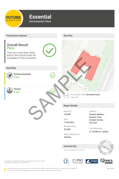
Future Climate Info Essential (< 0.25Ha)
The FCI Essential report will identify environmental and flood risks (with a Professional Opinion provided on all data), meeting the requirements of the Law Society’s guidance on flooding and contaminated land.
OneSearch Express (Existing Residential)
OneSearch Express (Existing Residential)